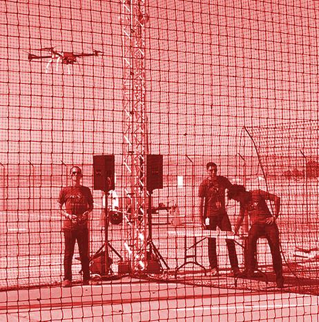
Cranfield, England's Cranfield University has announced that the first test flights to establish the principles for the National Beyond visual line of sight Experimentation Corridor (NBEC) were successfully conducted at Cranfield Airport.
A collaboration between Cranfield University and Blue Bear Systems Research Ltd, NBEC seeks to create an experimentation corridor that will enable UAS to fly in the same airspace as manned aircraft.
Using its Blackstart UAS towards its facility in Oakley, Bedfordshire, Blue Bear executed three-kilometer Extended Visual Line of Sight (EVLOS) race track flights within the Cranfield Air Traffic Zone.
Airspace
Airspace
Flight testing unmanned systems is more complicated than you may think
By Hannah Lemon, Marketing Publisher for the University of Kansas Edwards Campus
June’s flight of NASA’s Ikhana, a modified MQ-9 Predator B unmanned aircraft, into commercial airspace without a safety chase airplane marked a milestone for sense and avoid development and underscored the challenges of testing unmanned aircraft systems (UAS), according to George Cusimano.

North Dakota Gov. Doug Burgum proposes $30 million to support BVLOS UAS operations across state
North Dakota Gov. Doug Burgum recently announced a $30 million proposal to build out infrastructure that would support beyond visual line of sight (BVLOS) operations for UAS across the state.
The investment would establish a statewide BVLOS network to enable UAS operations such as automated farming and precision agriculture for state agencies, local communities and the commercial sector.
The investment would also supply the infrastructure needed for the command and control of UAS and the required surveillance equipment to safely integrate manned and unmanned aircraft in the National Airspace System.

DJI improving its geofencing technology to refine airspace limitations for UAS flights near airports
In an effort to provide smarter protection for airplanes in critical areas, DJI has announced that it is improving its geofencing technology to refine the airspace limitations for UAS flights near airports.
The updated Geospatial Environment Online (GEO) Version 2.0 will be phased in starting in November once the revised zones take effect for airspace around airports in the United States. DJI says that upgrades in other regions will follow in “due course.”
“DJI is proud to once again lead the industry in developing proactive solutions for safety and security concerns,” says Brendan Schulman, DJI Vice President of Policy & Legal Affairs.

FAA announces new LAANC service providers which include DJI, KittyHawk and Unifly
On Oct. 1, the FAA announced nine new partners to its Low Altitude Authorization and Notification Capability (LAANC) initiative, which is described as an “innovative collaboration between the FAA and the drone industry that provides near real-time processing of airspace authorizations for Part 107 drone operators nationwide who fly in controlled airspace.”
After the success of the FAA’s prototype, the initiative was simultaneously opened to other air traffic control facilities, as well as to new industry partners. A five-month onboarding process began back in April, resulting in nine new LAANC partners. Those partners are: Aeronyde, Airbus, AiRXOS, Altitude Angel, Converge, DJI, KittyHawk, UASidekick and Unifly.
NUAIR Alliance and Thales agree to collaborate on UTM research
The Northeast UAS Airspace Integration Research Alliance (NUAIR Alliance) has signed a multi-year collaboration agreement with Thales.
NUAIR says that the agreement supports its efforts to safely integrate UAS into “traditional, controlled airspace.” The agreement also supports NUAIR’s ability to conduct operations at its New York UAS test site’s 50-mile UAS traffic management (UTM) corridor at Griffiss International Airport.
NUAIR Alliance selects AirMap to provide UTM services for UTM 50-mile test corridor
The Northeast UAS Airspace Integration Research Alliance (NUAIR Alliance) and Rome, New York’s Griffiss International Airport have selected AirMap to provide UTM services to “visualize, manage, and support” UAS operations at the Griffiss New York UAS Test Site.
NUAIR Alliance is building a UTM 50-mile test corridor for beyond visual line-of-sight testing (BVLOS) in the U.S. Its partnership with AirMap will provide enhanced UTM capabilities for ongoing UAS operations.
“NUAIR Alliance is excited to bring in AirMap to power the test corridor with leading-edge UTM services,” says Maj. Gen. (ret.) Marke F. “Hoot” Gibson, CEO of the NUAIR Alliance. “Their global expertise is essential in accelerating the work we’re doing to advance UAS technologies.”

Griffiss International Airport to receive $800,000 in state funding for UAS technology
On Tuesday, July 24, New York State Senator Joseph Griffo announced that Griffiss International Airport is set to receive $800,000 in state funding for UAS technology.
$500,000 of that funding will be used to transform a hangar at the airport into a year-round UAS experimentation environment known as a “Sky Dome,” which will support the development of UAS technologies to operate safely and securely in the National Air Space (NAS).
This funding is in addition to $450,000 that was previously announced, Griffo says.
Deveron UAS Corp. awarded National Special Flight Operations Certificate for its UAS
Deveron UAS Corp. has been awarded a National Special Flight Operations Certificate (SFOC) for operations of its Rotary-Wing UAS.
The SFOC allows Deveron to operate nine more makes and models in its expanding UAS fleet, ultimately helping to meet common customer demands for increased operational flexibility.
With the ability to operate across Canada seamlessly, Deveron will not only have additional capabilities, but the company can also further expand its service to all regions as it offers “on-demand solutions” for growers, plant breeders, and research groups.
Black Swift Technologies to develop UAS to perform upper atmospheric observations of Venus
Black Swift Technologies (BST) has been awarded a NASA contract to develop a UAS to perform “upper atmospheric observations” of the planet Venus.
BST is proposing a “planetary aerial vehicle based on dynamic soaring,” which the company says is a “proven method to extract energy from atmospheric shear that has propelled the fastest small-scale aircraft in the world,” and provided the energy needed for “long-endurance low-level flights of birds across oceans.”