On a clear day from my home in Lancaster County, Pennsylvania, the airspace above our heads has an unobstructed view to the southwest filled with a brilliant azure blue sky. As the sun begins to set in the west and the sky takes on a reddish hue, a choreographed dance of airplane contrails fills our view above 18,000’, with a series of long vapor trails clearly separated by the same horizontal distance. This is the evening departure flow from the metropolitan New York City Airports traveling along established navigable Jet Routes (J6, J48, Q430 and Q480) to destinations scattered across the southwest United States within Class A airspace.
Airspace
Airspace
Mitigating UAS Disruptions at Airports
An unmanned aerial vehicle spotted at the Piedmont Triad International Airport in Greensboro, NC on March 9 caused operational difficulties, delayed flights, and raised concerns of gaps in security. Law enforcement agencies are seeking the public’s assistance in identifying the drone operator, with the FBI calling the incident an “illegal intrusion.” This is not the first time such an incident has occurred, and disruptions will likely continue to occur the federal government takes action to allow airports, and trained law enforcement, to detect and mitigate unauthorized UAS incursions.
Drone Federalism is the Wrong Move
A safe national airspace (NAS) is critical to American commerce, travel, and national security. The Federal Aviation Authority (FAA) has been directed by the U.S. Congress to control and actively manage our skies, which they have done admirably throughout the years. In fact, many nations look to American airspace management practices with envy, as our aviation record and dedication to safe skies speaks for itself.
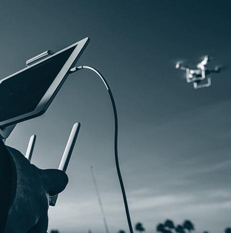
Red Cat, Fat Shark and Skypersonic complete long distance drone flight remotely
Red Cat Holdings Inc. has announced that Fat Shark, a wholly owned subsidiary, and Skypersonic, the manufacturer of the Skycopter UAV, partnered to complete a long distance drone flight remotely.
During the flight, a pilot located in Orlando, Florida controlled a drone flying in Detroit, Michigan. The flight integrated Fat Shark's new digital technology, "Shark Byte" with Skypersonic's Skycopter and remote pilot software system.

FAA announces Remote ID and operations over people final rules for UAS
On Monday, December 28, 2020, the FAA announced two final rules for UAS. The new rules will require Remote Identification (Remote ID) of drones and allow small UAS operators to fly over people and at night under certain conditions.
AUVSI Welcomes Remote ID and Operations Over People Final Rules for UAS
Today, the Federal Aviation Administration (FAA) has delivered a Final Rule on Remote Identification (ID) for unmanned aerial systems (UAS). Thought of as a digital license plate for drones, the objective of Remote ID is to ensure that a UAS in flight is providing identification and location information that authorities can access. The FAA also released the final rule for Operations Over People, which includes rules for operations at night.
senseFly establishes itself as a leader in BVLOS operations
As beyond visual line of sight (BVLOS) UAS operations are primed to open a range of possibilities in the drone industry, fixed-wing drone solutions provider senseFly has established itself as an early leader in safely and successfully performing these operations.

Drone Harmony decides to embed its flight mapping solutions with Altitude Angel's market-leading data
Unmanned Traffic Management (UTM) technology provider Altitude Angel has announced that software company Drone Harmony has opted to equip its flight mapping solutions with Altitude Angel’s market-leading data.
Drone Harmony is developing a data capture platform that enables enterprises to capture quality data of infrastructure assets. According to Altitude Angel, this addresses the main hurdle encountered when attempting to tap into digitalization benefits: the lack of complete, quality, and up-to-date digital databases representing the enterprise assets.

Tacoma passes resolution supporting responsible recreational drone use
In September, the Tacoma, Washington City Council passed Resolution 40658 supporting responsible recreational drone use in Tacoma. The resolution directs the City Manager to establish a point of reference on the city's website connecting Tacoma community members to federally established laws and regulations, as well as recommended best practices.

AeroVironment pilots Sunglider HAPS to achieve key test milestones
Last week, AeroVironment announced that the Sunglider solar-powered high-altitude pseudo-satellite (HAPS) achieved key test milestones during a September flight, including reaching an altitude of more than 60,000 feet above sea level and successfully demonstrating mobile broadband communication.