After being charged with the task of conducting the most comprehensive UAS-based inspections in the industry by Norfolk Southern back in early 2016, Virginia Beach-based Hazon Solutions has announced that it has inspected more than 100,000 linear feet of railway bridges.
Over the last year and a half, Hazon has conducted more than 64 complete bridge inspections across the eastern United States, which has left CEO and co-founder David A. Culler, Jr. CAPT USN (ret) extremely pleased.
“We're very proud to announce this remarkable milestone,” Culler says.
Technology
Technology

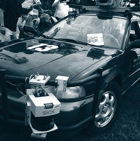
CDOT showcases autonomous vehicle designed to protect roadway maintenance crews
During a live roadway striping operation in Fort Collins, Colorado, the Colorado Department of Transportation (CDOT) and its partners unveiled and showcased the Autonomous Impact Protection Vehicle (AIPV), which is designed to help protect roadway maintenance crews.
Described as a “first-of-its kind work zone vehicle,” the AIPV is customarily positioned behind road construction crews so that it can protect road workers from the traveling public. Thanks to the AIPV removing the driver from a truck that is acrtually designed to be hit, the AIPV ultimately increases work zone safety for everybody.

WhiteFox demonstrates DroneFox technology during Joint Interagency Field Experimentation program
During the Joint Interagency Field Experimentation (JIFX) program from July 31 to August 4, WhiteFox Defense Technologies, Inc. demonstrated its DroneFox technology to a diverse group of U.S. military leaders.

Small UAS used during aircraft crash exercises at Edwards Air Force Base
During two aircraft crash exercises on July 31 and August 3, members of the 812th Civil Engineer Squadron teamed with the Emerging Technologies Combined Test Force (ETCTF) to “increase their emergency response capabilities” using small UAS.
Through the exercise scenario, the Edwards Fire Department at Edwards Air Force Base in California, and the 812th Explosive Ordnance Disposal (EOD) Flight were able to respond to a simulated crashed B-52 Stratofortress on Rogers Dry Lake.
The exercise allowed responders to approach an actual dismantled B-52 on the lakebed, and the B-52 was also used as an “aerial photo calibration target and later a radar target.”

Persistent Systems introduces Lower C-Band RF module that can be used by UGVs
Persistent Systems, LLC has released a Lower C-Band RF module for its MPU5 radio system.
According to Persistent, the Lower C-Band frequency is a “requirement of multiple Unmanned Ground Vehicle (UGV) Programs of Record.”
The new Lower C-Band module operates in the 4400 to 5000 MHz frequency band; the same frequency band that is used by NATO Military Forces, Federal / Homeland Security (DHS, DOJ), and Public Safety organizations.
Long range performance and high throughput are achieved thanks to Persistent’s radio module providing “6W of transmit power via its 3×3 MIMO architecture.”

Michigan’s Willow Run facility could be ready for autonomous car testing by December
According to the Detroit News, the American Center for Mobility (ACM) expects the Willow Run facility in Michigan to be ready for testing autonomous cars by December, after construction for the nonprofit operation began in June.
Test tracks at the facility could be available for use by December 1, giving automakers, Tier One suppliers and technology companies a place to test their autonomous vehicle technologies.
Canada’s Regina Police Service Traffic Unit receives DJI Phantom 4 UAS
In Regina, Saskatchewan, the Regina Police Service (RPS) Traffic Unit hopes to soon begin using a new DJI Phantom 4 Pro UAS for a variety of tasks, after the RPS received the unmanned system in early August.
Before the RPS Traffic Unit can use the UAS, Transport Canada must first certify the RPS for UAS use. That process has already started.
If and when the UAS is eligible to be used, there will be several use cases for it according to Constable Curtis Warnar.
“Say if we were doing a scene here and you had some skid marks or roadway evidence, you’re only seeing one angle versus when you can get up in the air and see the full picture,” Warnar says via Global News.

3D Robotics’ Site Scan now includes ground control points
3D Robotics (3DR) has announced that ground control points (GCPs) are now available to be processed in its Site Scan UAS data platform for engineering and construction.
GCPs are “easily-identifiable markers on the ground of a jobsite that can be used to ‘georeference’ drone maps and models,” which makes it possible to not only increase the absolute accuracy of UAS data, but also creates superior deliverables such as orthomosaics, point clouds, and more.
“Ground control points are a game-changer for Site Scan,” says Chris Swigert of Liberty Excavators.
“Now, I can easily tag and process GCPs in the cloud, and deliver my clients more accurate drone maps and models than ever before.”

Department of the Interior uses UAS to fly over active wildfire
After being granted permission by the FAA, the Department of the Interior recently used a fixed-wing UAS to fly over an active wildfire, according to KOBI5.com.
According to the U.S. Forest Service (USFS), this was the first time that the FAA allowed a UAS fly over a fire, beyond the visual line of sight of the pilot.
A Department of the Interior (DOI) UAS Pilot, Technician, and Wildland Firefighter, Steven Stroud, flew the UAS in the Modoc National Forest in northeastern California over a Parker 2 Fire. The UAS flew over 19 miles and covered more than 500 acres as it flew in a pre-programmed grid pattern.