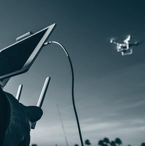
Cinematic Aerospace has announced that on April 11, it completed the first commercial UAS flight at John F. Kennedy (JFK) International Airport in Queens, New York.
Cinematic Aerospace flew a DJI Inspire 2 UAS at the TWA Flight Center to film for an upcoming documentary on the construction of the new TWA Hotel, and the history of the airport terminal.
Five flights were performed in the span of the approved flight window by UAS Pilot-in-Command Christian Tucci and Visual Observer Kyle Hurley. The UAS reached a maximum altitude of 200 feet while operating in various arcs over the TWA terminal building.
Photography
Photography

SenseFly's software integration with Trimble optimizes UAS mapping workflow for geospatial professionals
SenseFly has announced a new software integration with Trimble that optimizes the UAS mapping workflow for geospatial professionals, ultimately ensuring the smoothest possible end-to-end mapping UAS workflow.
Within their drone's recently launched eMotion 3.5 software, senseFly operators can now transform a senseFly S.O.D.A. camera’s georeferenced imagery into an “automatically-collated project (in .jxl format).”
This allows for the simple, one-click import of UAS imagery into the Trimble Business Center Aerial Photogrammetry module, without having to manually create a project and organize images.
DJI integrating FLIR thermal imaging sensor technology into new DJI Zenmuse XT2 drone camera
DJI will integrate a FLIR thermal imaging sensor technology into its new DJI Zenmuse XT2 drone camera, which is DJI’s first dual-sensor and most advanced gimbal-stabilized camera for commercial UAS applications.
The DJI Zenmuse XT2 is built with industrial and public safety applications in mind, and according to FLIR and DJI, the camera expands upon the benefits offered by the DJI Zenmuse XT, which is the first thermal-equipped camera jointly developed by the companies.

Skydio introduces R1, the 'world's first fully autonomous flying camera'
A California-based company called Skydio has announced the availability of its first product, R1, which is a fully autonomous flying camera. Skydio says that with the introduction of R1, it is “taking a step toward the future of autonomous drones and enabling a new type of visual storytelling.”
According to Skydio, a team of world-class researchers and engineers built R1 from the ground up for autonomous flight. The fully autonomous flying camera is powered by the Skydio Autonomy Engine, which allows it to “see and understand” the world around it, so that it can fly safely at high speeds while avoiding obstacles, even in dense and challenging environments.

DJI unveils smartphone-sized Mavic Air UAS
On Tuesday, Jan. 23, at an event in New York, DJI unveiled its latest product, Mavic Air, which the company describes as an “ultra-portable, foldable camera drone that delivers higher performance, more intelligent features and greater creative possibilities than any other consumer drone.”
According to DJI, Mavic Air was developed with the traveler and outdoor enthusiast in mind, as it inherits the best features of DJI’s Mavic series but is considerably smaller, at half the size and 40 percent of the weight. It's closer in size to the company's Spark, but actually has a smaller footprint because its rotor arms fold up, and it carries a better camera.

Calspan acquires UAS for aerial surveying, LIDAR mapping, and 3D photography
A company named Calspan has announced the acquisition, modification, and certification of a long-range, fixed-wing UAS, which will allow the company to “enter emerging markets that service public utilities and government agencies.” The company will use the UAS for aerial surveying, LIDAR mapping, and 3D photography.
In addition to acquiring the UAS, Calspan, which provides research and testing services in the aviation and transportation industries, has also obtained the necessary licenses and approvals from the FAA that enable commercial UAS operations under CFR Title 14 Part 107.

Measure to provide UAS services for arts and entertainment industry through new division
Measure, which provides UAS services for enterprise customers, has announced its new division called Measure Media (M2), which will be used to service the arts and entertainment industry.
M2 operates the first nationwide network of full-time UAS pilots that specialize in fulfilling the airborne storytelling needs of small screen and big screen projects alike.
During its first two months, M2 operated in stealth mode, but it has already worked with a wide range of customers, including pop star Rihanna, and television networks ABC and CBS.
Huangling and DJI partner to launch aerial photography base for UAS enthusiasts
Huangling, which is a countryside destination in Wuyuan County, Jiangxi Province, China, has partnered with DJI to launch an aerial photography base in the village.
The airspace around the village will be open to UAS enthusiasts, giving them the opportunity to use their systems for video-taking and photography purposes.
“We are thrilled to work with DJI to give visitors an exciting new way to view and appreciate the beauty of Huangling,” says Wu Xiangyang, CEO of Wuyuan Rural Culture Development Co., Ltd.

Revolution Aviation and Ultimate Drone Productions to offer UAS cinematography services
Flight school Revolution Aviation has partnered with aerial photography company Ultimate Drone Productions to begin offering cinematography services via UAS.
Through this partnership, Newport Beach, California-based Revolution Aviation—primarily known as its U.S.-registered trademark EatSleepFly—and Ultimate Drone Productions will provide a “full service photo and video cinematography production services.”
According to a press release published by Vertical Magazine, the demand for aerial imagery in Southern California is out-pacing supply, as there are just approximately 20,000 registered commercial UAS services in all 50 states.

DJI and National Geographic launch aerial photography contest
In partnership with National Geographic, DJI has launched an aerial photography contest that is open to amateur and professional photographers, as well as first time UAS users.
The contest, which will take place from September 5 to October 31, will run on the photo-sharing platform Instagram, and is open to residents of the United States and Canada.
Those that are interested in participating in the contest can upload their best aerial images to their Instagram account, and hashtag their entry with #MyMavicContest and #NatGeoTravel.
