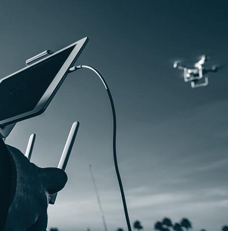
Terra Drone Europe, a group company of Terra Drone Corporation, has announced that it has secured a framework agreement to provide UAS services to the national mapping agency of the United Kingdom, Ordnance Survey.
Through this agreement, Terra Drone Europe will provide a variety of UAS services to Ordnance Survey, with deliverables including orthomosaics, digital terrain models (DTM) and digital surface models.
“This framework shows how Ordnance Survey is using new and innovative techniques to create the most accurate maps of the United Kingdom,” says Patrick Rickerby, technical director, Terra Drone Europe.
Data
Data

Dynam.AI, GBA partner to identify infrastructure defects using UAS and AI
Artificial intelligence technology provider Dynam.AI and GBA, a provider of engineering and architecture technologies, have announced that they will work together to identify defects in bridge roadway surfaces using a joint platform consisting of GBA’s UAS and Dynam.AI’s Auguste image detection and classification algorithm.
There are more than 47,000 structurally deficient bridges in the U.S. according to a 2019 study from the American Road & Transportation Builders Association. Traditionally, collecting the necessary data to determine the location and severity of the structural deficiencies would be done manually, which would require ground crews and extensive lane closures, creating hazards for drivers, road workers and inspectors.
Raptor Maps plans to expand global presence and develop new products using latest funding
Raptor Maps, a company that makes it simple and affordable for solar companies to adopt drone technology as a tool, has announced a new round of funding from veteran energy investors.
Raptor Maps develops software to build geospatial, digital models of photovoltaic (PV) system asset health. Over the last year, the company has analyzed more than 25 million solar panels in 21 countries across 6,000 MW. Uses include PV system inspection and verification, due diligence and construction site installation progression, to name a few.

Embry-Riddle, UCF partner to examine how UAS can be used to map oyster reefs
With a focus on 21 oyster reefs near Edgewater, Florida, Embry-Riddle Aeronautical University and the University of Central Florida (UCF) have partnered to develop methodologies for remotely mapping regions that are difficult, and expensive, to monitor on site.
The goal of the research is to utilize UAS to collect different types of information while surveying the reefs, without ever visiting the locations in person.
If the project is successful, it would represent progress, signaling a clear change in the way environmental data has traditionally been collected, according to Dr. Dan Macchiarella, professor of Aeronautical Science.
Airbus Aerial, Swiss Re Corporate Solutions partner to help companies identify flood risks using UAS
Airbus Aerial and Swiss Re Corporate Solutions are partnering to help companies efficiently identify flood risks and more accurately predict weather-related flood damage.
Through the collaboration, Airbus Aerial’s drone imagery and data will power FLOAT, the flood assessment tool of Swiss Re Corporate Solutions.
“We are very excited to announce our collaboration with a global leader in the commercial insurance market, and to be able to offer this unique solution to Swiss Re Corporate Solutions’ clients around the world,” says Jesse Kallman, president of Airbus Aerial, from the company’s Atlanta headquarters.
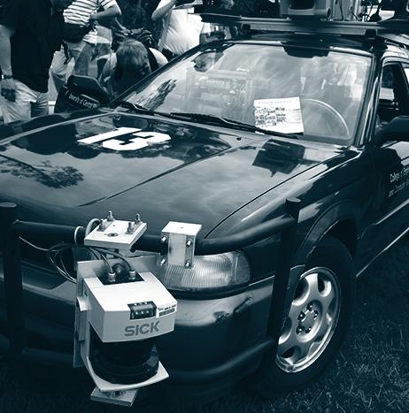
Cepton, Dataspeed partner to bring lidar technologies to autonomous vehicle developers
Cepton Technologies Inc. has partnered with autonomous vehicle (AV) technology provider Dataspeed Inc. to bring its high resolution, long-range and compact lidar technologies to AV developers.
The partnership will result in Dataspeed’s customers now having access to Cepton lidar technology for the development and deployment of autonomous applications.
“Dataspeed is a leading provider of by-wire systems with worldwide installations,” says Mitch Hourtienne, Cepton director of Business Development.
“Our partnership will make it easy for the global community to develop advanced perception capabilities for the next generation of autonomous vehicles.”
Wood uses Delair's UX11 UAS for mining and quarry projects
Wood, a provider of project, engineering and technical services to the energy, industry and built environment sectors, has adopted Delair’s UX11 UAS for its work in site planning and asset management in mining and quarry projects in the western part of the United States. This is the first fixed-wing UAS that Wood has deployed in the Western U.S.
Initially, Wood is using the UAS to conduct high accuracy, 3D topographic surveys and materials quantification for mineral mining in Idaho and Wyoming.

AeroVironment, Kratos partner to develop multi-domain unmanned platforms
AeroVironment Inc. and Kratos Defense & Security Systems Inc. are teaming up to develop and demonstrate “highly integrated and operationally effective” multi-domain unmanned platforms for near-peer, denied environments.
The companies say that their first collaborative project is designed to demonstrate the ability to launch, communicate with, and control a small, tube-launched loitering aircraft from a larger runway-independent UAS.
“Kratos and AeroVironment offer complementary capabilities while sharing an intense focus on disruptive and affordable unmanned aircraft solutions for the DoD,” says Steve Fendley, president of Kratos Unmanned Systems Division.

UAVOS' new Auto-Tracking Antenna System designed to incorporate UAS
UAVOS has introduced its new Auto-Tracking Antenna System, which the company describes as a portable ground-to-air antenna designed to incorporate UAS.
Particularly suitable for UAS applications, the tracking antenna enables long-range data transmission. UAVOS says that the quality and range of stable communication transmission is greatly increased when the Tracking Antenna System is combined with the company's ground control unit.
Red Cat's black box flight recorder makes UAS trackable and accountable
A company called Red Cat that provides distributed data storage, analytics and services for the UAS industry has announced the beta release of its blockchain-based black box storage, analytics and services platform, which makes UAS trackable and accountable.
Red Cat says that its platform release includes several integrated systems that allow industry regulators to track and review UAS flight data, insurance companies to insure UAS with reliable third-party data, and pilots to ensure compliance with regulators.
According to Red Cat, its black box flight recorder is the first distributed system with secure and encrypted third-party data that regulators and insurance companies can trust.
